

- Visiting Iceland
- Travel Information
- FAQ
- Protected Areas
- Westfjords
- Breidafjordur
- Dynjandi in Arnarfjordur
- About the area
- Access and services
- Pay for parking
- Nature
- Culture and history
- Drone use at Dynjandi
 Dynjandi in Arnarfjordur
 - Flatey in Breidafjordur
- Hornstrandir
- Hrisey, Reykholahreppur
- Surtarbrandsgil
- Vatnsfjordur
Westfjords - North West
- North East
- Boggvistadafjall
- Dettifoss and a row of waterfalls
- Dimmuborgir
- Public park in Glerardalur
- Reservation in Svarfadardalur
- Godafoss in Thingeyjarsveit
- Hraun in Oxnadalur
- Hverastrytur in Eyjafjordur
- Hverfjall
- Krossanesborgir
- Myvatn and Laxa
- Seljahjallagil
- Skutustadagigar
- Vatnajokull National Park
- Vestmannsvatn
North East - West
- Andakill
- Bardarlaug, Snaefellsbaer
- Blautos and Innstavogsnes
- Breidafjordur
- Budahraun
- Einkunnir, Borgarbyggd
- Eldborg in Hnappadalur
- Geitland, Borgarbyggd
- Grabrokargigar, Borgarbyggd
- Grunnafjordur
- Hraunfossar, Borgarbyggd
- Husafellsskogur, Borgarbyggd
- Kalmanshellir
- Melrakkaey
- Stedji (Staupasteinn)
- The coast by Stapi and Hellnir
- Vatnshornsskogur, Skorradalur
- Snaefellsjokull National Park
West - Search by name
- East
- South West
- Akurey
- Alafoss, Mosfellsbaer
- Astjorn, Hafnarfjordur
- Astjorn and Asfjall, Hafnarfjordur
- Bakkatjorn, Seltjarnarnes
- Blafjoll Public Park
- Borgir, Kopavogur
- Bringur, Mosfellsdalur
- Burfell, Gardabaer
- Eldborg in Blafjoll
- Eldborg in Geitahlid
- Eldey, Reykjanesbaer
- The shore by Kasthusatjorn
- Fossvogsbakkar, Reykjavik
- Gardahraun, Gardabaer
- Galgahraun, Gardabaer
- Grotta, Seltjarnarnes
- Hamarinn, Hafnarfjordur
- Haubakkar, Reykjavik
- Hleinar, Hafnarfjordur
- Hlid, Alftanes
- Hvaleyrarlon and Hvaleyrarhofdi
- Kaldarhraun and Gjarnar
- Kasthusatjorn, Alftanes
- Laugaras, Reykjavik
- Litluborgir, Hafnarfjordur
- Raudholar, Reykjavik
- Reykjanes Public Park
- Skerjafjordur, Gardabaer
- Skerjafjordur, Kopavogur
- Stekkjarhraun, Hafnarfjordur
- Trollaborn, Lækjarbotnar
- Tungufoss, Mosfellsbaer
- Valhusahaed, Seltjarnarnes
- Varmarosar, Mosfellsbaer
- Vifilsstadavatn, Gardabaer
- Vigholar, Kopavogur
South West - South
- Alftaversgigar
- Arnahellir in Leitahraun
- Dverghamrar
- Dyrholaey
- Fjallabak Nature Reserve
- Geysir Area
- Gullfoss
- Herdisarvik
- Jorundur in Lambahraun
- Kerlingarfjoll
- Kirkjugolf
- Oddaflod
- Pollengi and Tunguey
- Skogafoss
- Surtsey
- Area in Thjorsardalur
- Vatnajokull National Park
- Videy in Thjorsa
- Thingvellir National Park
- Thjorsarver
South - Mývatn and Laxá
- National Parks
Protected Areas - Westfjords
- Permits in protected areas
- Operational licence
- Photography, cinematography and drone flying
- Research permit
Permits in protected areas - Drones in protected areas
- Guidelines for using drones in protected areas
- Flights in protected areas
- Apply for permit
Drones in protected areas - Volunteers
- Snæfellsjökull National Park
Visiting Iceland - Wildlife
- Air & Climate
- Ocean & Water
- Industry
- Chemicals
- Frequently asked questions
- Biocides
- Classification and labelling – CLP
- Cosmetics
- Detergents
- Fluorinated greenhouse gases (F-gases)
- Fuel
- Certificate for pest control
- Certificate for professional use of plant protection products
- Plant protection products
- POPs
- REACH
- Safety data sheets
- Supervision, inspection and coercive measures
Frequently asked questions - Biocides
- Classification and labelling
- CLP
- Classification
- Labelling
- Packaging and retention
Classification and labelling - Cosmetics
- Detergents
- F-gases
- Fuel
- Plant protection products
- Authorisation
- Harmonised Risk Indicators
Plant protection products - POPs
- REACH
- Fees
Chemicals - Frequently asked questions
- Importation of Alien Species
- ETS
Industry - Chemicals
- Circular Economy
- Waste
- Waste Management
Circular Economy - The Agency
.svg)
Laugaras, Reykjavik
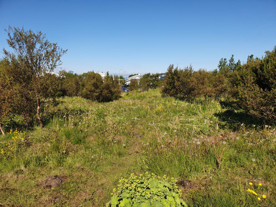
Laugarás was declared a nature reserve in 1982. The area contains geological remnants such as rocks with glacial scratches as well as signs of ocean levels at the close of the Ice Age.
Nature reserves are areas that are seen as important for their research value, beauty or special characteristics. The objective of declaring Laugarás as a nature reserve is to protect rare landscapes as well as the intent of keeping an area open where it would be possible to inspect the remarkable landscape characteristics of it.
Landscape remnants
The landscape characteristics in Laugarás are mostly confined to the highest point in the area with basalt rocks, well-rounded cliffs and large boulders about 200 thousand years old that constitute a part of the Reykjavík basalt rock formation. The glaciers of the Ice Age shaped the basalt rocks and glacial scratches can be observed in the larger rocks. The ocean level rose at the end of the Ice Age, and Laugarás was one of the few places that did not go under water; the ocean level was about 45 metres higher than at present. Only the highest part of Laugarás was above water, not much more than a skerry. The sea-shorn remnants can be seen at the highest point of the area.
The geological remnants of the area give good insight into the geology of Reykjavík, providing information on climate and landscape changes.
Vegetation and animal life
The declaration of Laugarás as a nature reserve is not only important to preserve landscape but also to preserve original rock vegetation in the middle of a densely populated area where original, characteristic species are dominant and constitute species-rich vegetation communities. In earlier times, such rock vegetation was dominant in the area, but now it is on the defensive against the lupine and growing trees. The lupine creates large and dense fields that sometimes obscure or hide landscape features. The birch is the most common type of tree, and the sallow is quite common. Other tree species are mountain ash, salix, Alaskan black cottonwood, woolly willow, beach pine and alder.
There are various birds in the area, such as starling, blackbird and redpoll. Flies and butterflies are the most prevalent insects, especially bumblebees, wasps, birch- and ash creepers as well as various double-wingers. Some toadstools are to be found in the vegetation.
The nature reserve is 1.5 hectares.
For guests – Trekking in the area – Useful information – Points of interest
The Laugarás nature reserve is located in Laugarásholt in the Langholtshverfi district of Reykjavík. The area is demarcated by Vesturbrún to the west up to Austurbrún, Dyngjuvegur and Vesturbrún to the south. In the north and east the area extends to the residential section of Austurbrún and Vesturbrún and is therefore located in the middle of a residential area.
The area surrounds the highest point of the Laugarás hill, 50 metres above sea level, where the landscape features are best seen.
There is a parking lot at the edge of the area to the south, at Vesturbrún. There is no place for bicycles in the area. There is a footpath from the parking area up to the highest point. There are signs with information at the footpath. There are other footpaths in the area, mostly tracks rather than actual footpaths. Most of the paths lead to the highest point in the area, where a concrete pillar defines the measuring points for the Icelandic National Land Survey.
There is a good view from the top of the area in all directions, over the city, the fjords and channels and up to the mountains.
Rules to be observed
- The landscape may not be disturbed in any way.
- Pedestrians are allowed in the area, provided they exercise care.
- The discharge of soil and garbage is not allowed.
Administration – operation
Laugarás was declared a nature reserve in 1982 with a Notice no. 41/1982 in the B-section of the Government Gazette. The area is overseen by the City of Reykjavík with an agreement concluded in June 2015. At the same time, a preservation and management programme were agreed to, valid until 2024.
Laugarás is on an orange list of endangered areas.
Map of the area