

- Visiting Iceland
- Travel Information
- FAQ
- Protected Areas
- Westfjords
- Breidafjordur
- Dynjandi in Arnarfjordur
- About the area
- Access and services
- Pay for parking
- Nature
- Culture and history
- Drone use at Dynjandi
 Dynjandi in Arnarfjordur
 - Flatey in Breidafjordur
- Hornstrandir
- Hrisey, Reykholahreppur
- Látrabjarg
- For seafarers
Látrabjarg - Surtarbrandsgil
- Vatnsfjordur
Westfjords - North West
- North East
- Boggvistadafjall
- Dettifoss and a row of waterfalls
- Dimmuborgir
- Public park in Glerardalur
- Reservation in Svarfadardalur
- Godafoss in Thingeyjarsveit
- Hraun in Oxnadalur
- Hverastrytur in Eyjafjordur
- Hverfjall
- Krossanesborgir
- Myvatn and Laxa
- Seljahjallagil
- Skutustadagigar
- Vatnajokull National Park
- Vestmannsvatn
North East - West
- Andakill
- Bardarlaug, Snaefellsbaer
- Blautos and Innstavogsnes
- Breidafjordur
- Budahraun
- Einkunnir, Borgarbyggd
- Eldborg in Hnappadalur
- Geitland, Borgarbyggd
- Grabrokargigar, Borgarbyggd
- Grunnafjordur
- Hraunfossar, Borgarbyggd
- Husafellsskogur, Borgarbyggd
- Kalmanshellir
- Melrakkaey
- Stedji (Staupasteinn)
- The coast by Stapi and Hellnir
- Vatnshornsskogur, Skorradalur
- Snaefellsjokull National Park
West - Search by name
- East
- South West
- Akurey
- Alafoss, Mosfellsbaer
- Astjorn, Hafnarfjordur
- Astjorn and Asfjall, Hafnarfjordur
- Bakkatjorn, Seltjarnarnes
- Blafjoll Public Park
- Borgir, Kopavogur
- Bringur, Mosfellsdalur
- Burfell, Gardabaer
- Eldborg in Blafjoll
- Eldborg in Geitahlid
- Eldey, Reykjanesbaer
- The shore by Kasthusatjorn
- Fossvogsbakkar, Reykjavik
- Gardahraun, Gardabaer
- Galgahraun, Gardabaer
- Grotta, Seltjarnarnes
- Hamarinn, Hafnarfjordur
- Haubakkar, Reykjavik
- Hleinar, Hafnarfjordur
- Hlid, Alftanes
- Hvaleyrarlon and Hvaleyrarhofdi
- Kaldarhraun and Gjarnar
- Kasthusatjorn, Alftanes
- Laugaras, Reykjavik
- Litluborgir, Hafnarfjordur
- Raudholar, Reykjavik
- Reykjanes Public Park
- Skerjafjordur, Gardabaer
- Skerjafjordur, Kopavogur
- Stekkjarhraun, Hafnarfjordur
- Trollaborn, Lækjarbotnar
- Tungufoss, Mosfellsbaer
- Valhusahaed, Seltjarnarnes
- Varmarosar, Mosfellsbaer
- Vifilsstadavatn, Gardabaer
- Vigholar, Kopavogur
South West - South
- Alftaversgigar
- Arnahellir in Leitahraun
- Dverghamrar
- Dyrholaey
- Fjallabak Nature Reserve
- Geysir Area
- Gullfoss
- Herdisarvik
- Jorundur in Lambahraun
- Kerlingarfjoll
- Kirkjugolf
- Oddaflod
- Pollengi and Tunguey
- Skogafoss
- Surtsey
- Area in Thjorsardalur
- Vatnajokull National Park
- Videy in Thjorsa
- Thingvellir National Park
- Thjorsarver
South - Mývatn and Laxá
- National Parks
Protected Areas - Westfjords
- Permits in protected areas
- Operational licence
- Photography, cinematography and drone flying
- Research permit
Permits in protected areas - Drones in protected areas
- Guidelines for using drones in protected areas
- Flights in protected areas
- Apply for permit
Drones in protected areas - Volunteers
- Snæfellsjökull National Park
Visiting Iceland - Wildlife
- Air & Climate
- Air pollution during a volcanic eruption
- EU ETS
Air & Climate - Ocean & Water
- Industry
- Chemicals
- Frequently asked questions
- Biocides
- Classification and labelling – CLP
- Cosmetics
- Detergents
- Fluorinated greenhouse gases (F-gases)
- Fuel
- Certificate for pest control
- Certificate for professional use of plant protection products
- Plant protection products
- POPs
- REACH
- Safety data sheets
- Supervision, inspection and coercive measures
Frequently asked questions - Biocides
- Classification and labelling
- CLP
- Classification
- Labelling
- Packaging and retention
Classification and labelling - Cosmetics
- Detergents
- F-gases
- Fuel
- Plant protection products
- Authorisation
- Harmonised Risk Indicators
Plant protection products - POPs
- REACH
- Fees
Chemicals - Frequently asked questions
- Importation of Alien Species
- ETS
Industry - Chemicals
- Circular Economy
- Waste
- Waste Management
Circular Economy - The Agency
Vinna við nýjar heimasíður Umhverfis- og orkustofnunar og Náttúruverndarstofnunar er í gangi. Heimasíða Umhverfisstofnunar er virk á meðan vinnunni stendur. Information in English
.svg)
Grunnafjordur
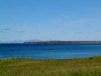
Grunnafjörður was protected as a nature reserve in 1994. The aim of the protection was to preserve the landscape and ecosystems of the area, particularly the birdlife, which is extremely rich. The nature reserve covers an area of 1393.2 ha.
In 1996, the area was approved as a Ramsar area. Since then, it has been protected in accordance with the Convention on Wetlands of International Importance. The fjord is the only Ramsar area in Iceland that is coastal. The Ramsar area covers an area of approx. 1,470 hectares.
Where Is Grunnafjörður?
Grunnafjörður (Leirárvogar) is northeast of Akranes in Borgarfjarðarsýsla and belongs to Skilmanna-, Leirár- and Melahreppur. Highway 1 is near the nature reserve. The nature reserve includes all beaches and all shallow waters within Hvítanes and Súlueyri. On the land side, the nature reserve is marked by the high current flood limits and includes all the islands and skerries in the fjord. All land within the nature reserve is privately owned.
Points of Interest
There are vast mudflats in Grunnafjörður, and it could be argued that the fjord is more of a mudflat lagoon than an actual fjord.
Sites of Natural Interest
The Grunnafjörður nature reserve has numerous habitat services. The area has fertile soil which, along with other factors, makes the area a suitable habitat for wild plants and animals. Therefore, maintenance of biological and genealogical diversity occurs in Grunnafjörður. There is hunting in the area, and the utilisation of the land is considerable. In addition, the area has a diversity of natural ecosystems that provide the opportunity to use its resources for decorative purposes. The nature reserve also has a high informational value, as it is characterised by beautiful natural formations that offer recreational possibilities like horseback riding. Grunnafjörður has cultural, artistic, spiritual and historical value; many folklores and tales about the area exist, and the nature of the area has high scientific and educational value as well.
Grunnafjördur’s uniqueness lies its vastness and the fact that it contains many large areas of different types of mudflats, although lugworm mudflats dominate the area. Animal species common to the area include chironomidae, fabricia sabella and bristleworms, arenicolidae, terricolae, nereis diversicolor, amphipods, idotea, algae and mussels. Fish species found in the area are salmon, brown trout, Arctic charr, sole (dab), lumpfish, pollock, lesser sand-eel, cod and seals. Minks and foxes have also been spotted.
Grunnafjörður is important for many bird species. The area is internationally important for brant geese, red knots and sanderlings. About 25% of the brant goose population use Grunnafjörður as a stop-over point on their migration route between the European mainland and the Arctic in spring and autumn, as does approx. 1% of the red knot population.
Many water birds, such as purple sandpipers, dunlins, ringed plovers and Eurasian oystercatchers, depend on the mudflats’ ecosystem for their survival. The fjord is also the habitat of eider ducks. Many bird species depend on Grunnafjörður during winter, including oystercatchers. Several species on the threatened list have been spotted during bird counts, such as the common shelduck, short-eared owl, greylag goose, raven and great black-backed gull. Other common bird species in the area are species such as cormorant, scaup, golden plovers, godwits, lesser black-backed gulls, glaucous gulls and black-headed gulls, and falcons and marlins have also been spotted.
Cultural Heritage
A number of folktales, folklore and even the Icelandic Sagas are connected to Grunnafjörður. Heimskringla mentions men gathering at Arkarlækur to plan the battle with Hörður Hólmverji, when at the time, the local assembly area was on the banks of Laxá, which indicates that the fjord may not have been as open as it is today. There are also rumours that Egill Skallagrímsson may have had his smithy in the area where Skipanes is now.
Over the centuries, many people have died on the mudflats due to quicksand, riptides or by falling through the ice in winter. The old road through the fjord was by Skorholt and from there through the province down to Akranes. The fjord was also commonly crossed at low tide, from Skipanes to Arkarlækur. In Akranes, there is a rock behind the shipyard that was used as a reference point when crossing the fjord. When the sea reached a certain height on the rock, it was time to return home from Akranes.
Access
All land within the nature reserve is privately owned, and 11 farms border it. Access to the nature reserve is limited, and no hiking trails have been marked. The local schools and universities use the area for field trips and project work. During the period between April 15th and July 15th, all visits to the islands and skerries, other than those involving traditional use, are prohibited. Excluding that period, the nature reserve is accessible all year round with the landowners’ permission.
The natural monument covers an area of 36.1 ha.